
Sutton, London
Rear extension drawings in Sutton
Rear extension drawings for a Sutton house start at £695 including VAT. Sutton's extension guidance sets depths by house type, and for terraced and detached houses they sit below the national permitted development limits, so the type of house you own decides how far the drawings can go.
From £695 (VAT included)
- MCIAT chartered
- £2m PI insured
- LABC Partnered
- Fixed fees, VAT included
Request a fixed quote
Sutton's depth limits by house type
The council's Design of Residential Extensions SPD sets out what it expects for single-storey rear extensions, house type by house type. For terraced houses: 2.7 m. That is the projection; the same rule also caps the height to the eaves or a flat roof.
For semi-detached houses the guide reads: 3 m (max 3.5 m). Detached houses are treated more generously: 3.5 m, for example where there is a significant distance to the boundaries.
The guide adds a warning for terraces. A full-width extension to a mid-terrace house may be unacceptable if it affects the neighbours' amenity, and an extension should not take up the whole length of the garden. The depth figures are therefore a ceiling rather than an entitlement.
Local figures for Sutton
| Measure | Value | Period | Source |
|---|---|---|---|
| Terraced houses: rear extensions should not project more than 2.7 m, no higher than 2.5 m to the eaves or a flat roof. | 2.7 m | — | sutton.gov.uk, Design of Residential Extensions SPD 2006, p.18, para A.1.3 |
| Semi-detached houses: up to 3 m deep, up to a maximum of 3.5 m, limited to 2.5 m to the eaves if on or close to the boundary. | 3 m (max 3.5 m) | — | sutton.gov.uk, Design of Residential Extensions SPD 2006, p.18, para A.1.3 |
| Detached houses: up to 3.5 m can be considered, e.g. with significant distance to boundaries. | 3.5 m | — | sutton.gov.uk, Design of Residential Extensions SPD 2006, p.18, para A.1.3 |
| Domestic gardens share of land (GLUD 2005) | 34.5 % of land that is domestic garden (GLUD 2005) | 2005 | data.london.gov.uk |
| Green Belt share of the council area | 14 % of council area covered by green-belt polygons | — | planning.data.gov.uk |
| Conservation areas | 8 named conservation areas published by the council | — | planning.data.gov.uk |
| Listed building entries | 209 list entries (Historic England, within the LPA boundary) | — | planning.data.gov.uk |
| Householder decisions | 601 decisions | 1 July 2025 - 30 June 2026 | assets.publishing.service.gov.uk |
| Householder applications granted | 91.8 % | 1 July 2025 - 30 June 2026 | assets.publishing.service.gov.uk |
| Householder applications decided in time | 94.8 % decided within 8 weeks or an agreed extended period | 1 July 2025 - 30 June 2026 | assets.publishing.service.gov.uk |
| GPDO 2015 Sch 2 Pt 1 Class A, para A.1(f)(i) | 3 m (attached) / 4 m (detached) beyond the original rear wall, single storey | — | legislation.gov.uk |
A blank value means the figure has not been published, not that there are none. Check your own address with the council.
Householder applications by street in Sutton
| Street | Applications | Approved |
|---|---|---|
| Higher Drive | 35 | 70% |
| Oaks Avenue | 31 | 79% |
| Banstead Road South | 30 | 90% |
| The Gallop | 28 | 93% |
| Ridge Road | 26 | 80% |
| Foresters Drive | 23 | 91% |
| Pine Ridge | 23 | 85% |
| Pine Walk | 23 | 83% |
| Boundary Road | 22 | 76% |
| Caldbeck Avenue | 22 | 73% |
| Cornwall Road | 22 | 82% |
| Carshalton Park Road | 21 | 71% |
| Kingsmead Avenue | 21 | 90% |
| Alington Grove | 20 | 95% |
| Chiltern Road | 20 | 90% |
Single-storey rear extension: the permitted development limits
The house in section with a rear extension; the dashed lines mark the zone near the boundary.
- A · Depth beyond the original rear wall
- 3 m (attached) / 4 m (detached) beyond the original rear wall, single storey
- B · Maximum height
- 4 m
- C · Within the zone near the boundary
- Eaves no higher than 3 m where within 2 m of the curtilage boundary
- D · Larger extension under prior approval
- 6 m (attached) / 8 m (detached), single storey, height max 4 m; not on article 2(3) land or an SSSI
Why the council guide differs from permitted development
For terraced and detached houses the national permitted development limit is deeper: 3 m (attached) / 4 m (detached) beyond the original rear wall, single storey. A scheme can be lawful without any application and yet be deeper than Sutton's guide would accept if it were applied for. If you want certainty on the lawful route, a Lawful Development Certificate in Sutton records it.
If you want more than the guide offers, the design goes to the council as a householder application, and the drawings must carry the argument for the extra depth. We usually show a section through the neighbour's nearest window and the boundary treatment.
Prior approval offers a third route for deeper single-storey work: 6 m (attached) / 8 m (detached), single storey, height max 4 m; not on article 2(3) land or an SSSI. The council then looks only at the effect on neighbours.
Gardens, Green Belt and heritage in Sutton
Domestic gardens cover about 34.5 per cent of the borough's land in the Greater London land-use survey. Green Belt designation covers 14 per cent of the borough.
Sutton has 8 conservation areas and Historic England lists 209 entries. We check the address against both before drawing so you know early.
How Sutton decides householder applications
In its latest published year Sutton decided 601 householder applications and granted 91.8 per cent. The share decided on time, within eight weeks or an agreed extension, was 94.8 per cent.
These borough-wide numbers are about the past. They do not tell you the outcome for one house, and we do not use them that way.
Rear extension drawings in Sutton: price and contents
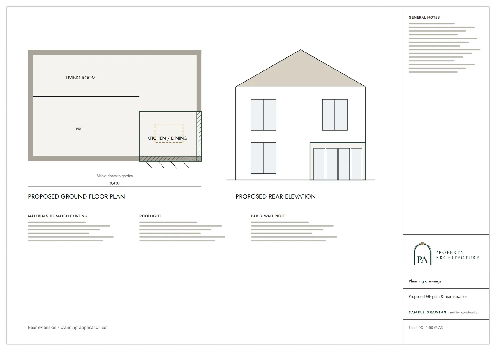
Our drawings start at £695, VAT included, fixed in advance. You get existing and proposed plans, elevations and sections, plus the location plan and block plan. A second chartered technologist checks every sheet and we redraw at no charge if the council asks for changes.
The Building Regulations then govern the build. New elements must meet: New elements in existing dwellings, limiting U-values W/(m²·K): roof 0.15, wall 0.18, floor 0.18, windows 1.4 (or WER Band B), doors 1.4. Our building regulations drawings in Sutton set that out for the builder and building control.
Surveying a Sutton house against the guide
The house type decides which depth applies, so we confirm it on site: terraced, semi-detached or detached, and whether the property sits close to either boundary. The guide ties the detached depth to distance from the boundaries, so we measure those distances rather than assume them.
We also record what has already been built at the back, including earlier extensions and conservatories. They count towards the projection the council measures, and a clear record avoids a surprise at validation.
Related drawings and neighbouring councils
A larger scheme might be a double-storey extension in Sutton or a wraparound extension. The whole borough is covered at architectural drawings in Sutton.
See how neighbours treat the same project in Croydon, Merton and Kingston upon Thames. Our national guide is on the rear extension drawings page.
What you receive
Related pages
Other services in Sutton
Rear extension drawings nearby
Questions
How far can I extend a terraced house in Sutton?
The SPD says a terraced house should project no more than 2.7 m at the back. Permitted development has a different limit: 3 m (attached) / 4 m (detached) beyond the original rear wall, single storey.
And a semi-detached or detached house?
Semi-detached: 3 m (max 3.5 m). Detached: 3.5 m, where distances to the boundaries allow.
Can I extend across the full width of a terraced house?
It may be unacceptable if it harms the neighbours' amenity. Sutton's guide says full-width extensions to mid-terraces are a particular concern.
How much do rear extension drawings cost in Sutton?
From £695 including VAT, fixed up front. The council's householder fee of £548 is separate.
Sources and dates
- sutton.gov.uk, retrieved
- data.london.gov.uk, retrieved
- planning.data.gov.uk, retrieved
- planning.data.gov.uk, retrieved
- planning.data.gov.uk, retrieved
- assets.publishing.service.gov.uk, retrieved
- legislation.gov.uk, retrieved
- sutton.gov.uk, retrieved
- gov.uk, retrieved
- ribblevalley.gov.uk, retrieved
- Contains public sector information licensed under the Open Government Licence v3.0.
- Contains OS data © Crown copyright and database right 2026.
- Contains HM Land Registry data © Crown copyright and database right 2026. This data is licensed under the Open Government Licence v3.0.
- Contains Historic England data © Historic England 2026. Contains Ordnance Survey data © Crown copyright and database right 2026.

Tell us about your property.
We check the constraints, then send a fixed fee. Messages before 3pm get a reply the same working day.