
Westminster, London
Basement impact assessment in Westminster
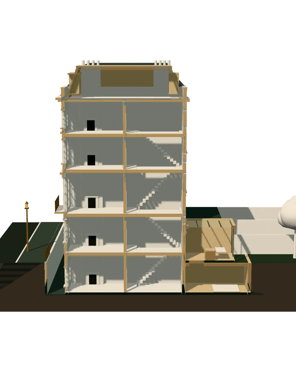
Westminster sets numeric limits on how much garden a basement may sit under, how deep it may go, how much soil must cover it and how far it may reach beneath the pavement. We build the basement impact assessment around those limits on a fixed quote after a free constraints check.
Fixed quote after a free constraints check
- MCIAT chartered
- £2m PI insured
- LABC Partnered
- Fixed fees, VAT included
Request a fixed quote

How we work on basement impact assessments
Seven steps from first call to approval.
Enquiry and constraints check
We check the property against conservation areas, listed status, Article 4 directions, tree preservation orders, flood zone and planning history. We choose the right route and send a fixed quote.
Measured survey
We survey the house on one datum: rooms, levels, boundaries, drains, trees and the neighbours' windows that the 45° and 25° tests depend on.
Design options
We model the house in Revit and show you options in 3D and plan, with the planning strategy and the precedents in your street.
Design frozen
You choose an option in writing. Nothing changes after this without your say.
Independent check
A second chartered technologist checks every sheet against the council's validation checklist and the policy. A senior review signs it off before anything is submitted.
Submission
We prepare the forms, certificates, fee and documents and submit through the Planning Portal.
Officer liaison
We answer the planning officer and make any amendments within five working days, at no charge until approval.
Free redraws until approval. Every drawing set is checked independently, and the checker is never the person who drew it.
Request a fixed quote
Westminster's basement policy: the limits we draw to
The City Plan 2019-2040 (2026) carries the policy, adopted in 2,026. In short, the council's headline limits are: 50% garden; 1 storey; 1 m soil + 200 mm drainage; 1.8 m / 900 mm highway. The same policy sets a margin of undeveloped garden around the dig, and exceptions only on larger sites.
The council's own reading of the depth limit is a single storey, and its summary figure reads: about 2.7 m storey. The supporting text puts that at roughly a single storey of floor-to-ceiling height measured down from the lowest part of the original floor, so the starting level of your existing lower floor decides how much headroom you can add.
Gardens get a separate rule, summarised as Basement under garden land: landscaping strategy. We prepare that strategy as a drawing, with soft landscaping and permeable surfacing above the roof of the basement, so that the officer sees how the garden will look after the dig, not only the section that goes below it. The highway limit has its own drawing too: a section through the pavement showing the depth the basement keeps below the surface.
Taken together, these limits make Westminster the borough where the design is settled by the policy before the engineer is appointed. We therefore ask for a measured survey first, check the plot against each limit in turn, and tell you the largest basement the policy appears to allow before you commission any specialist work.

Local figures for Westminster
| Measure | Value | Period | Source |
|---|---|---|---|
| City Plan Policy 50 (Policy 45 in the 2021 plan): basements extend under no more than 50% of garden land (on small sites with a garden of 8 m or less, up to 4 m from the original building); leave a proportionate margin of undeveloped garden; comprise no more than one storey beneath the lowest original floor level; provide at least 1 m soil depth plus 200 mm drainage layer above the basement; and encroach no more than 1.8 m under the highway, keeping 900 mm depth below the highway surface. | 50% garden; 1 storey; 1 m soil + 200 mm drainage; 1.8 m / 900 mm highway | — | westminster.gov.uk, Westminster City Plan 2019-2040 (as revised, adopted 21 January 2026), Policy 50, p.203; paras 50.7-50.11, p.204-205 |
| Policy 50 para 50.9: the most appropriate basement is no more than one storey (approximately 2.7 m floor to ceiling) below the lowest part of the original floor level; exceptions only on large sites able to accommodate construction access. | about 2.7 m storey | — | westminster.gov.uk, Westminster City Plan 2019-2040 (as revised, adopted 21 January 2026), Para 50.9, p.205 |
| Item L9 and City Plan para 50.4: a signed Appendix A of the Code of Construction Practice (Checklist B) is required for all development involving basement excavation. Item L17 and para 50.3: a site-specific Flood Risk Assessment and a structural statement are required for basements in flood zone 2 or 3 or surface water flood risk hotspots. | CoCP Appendix A signed; FRA in FZ2/3 | — | westminster.gov.uk, Westminster Local Planning Applications Validation Requirements Check List (Full List; 2021 version, pre-2026 policy numbering), p.9, item L9; p.12, item L17; City Plan p.204, paras 50.3-50.4 |
| Item L21 Landscaping Strategy / Urban Greening Factor: a landscaping strategy and details are required for basement development extending below garden land (and for major development); para 50.6 asks for soft landscaping, planting and permeable surfacing above basements. | Basement under garden land: landscaping strategy | — | westminster.gov.uk, Westminster Full List of Local Planning Application Requirements, p.14, item L21; City Plan para 50.6, p.204 |
| Conservation areas | 56 named conservation areas published by the council | — | planning.data.gov.uk |
| Article 4 directions | 10 Article 4 directions published by the council | — | planning.data.gov.uk |
| Listed building entries | 4,015 list entries (Historic England, within the LPA boundary) | — | planning.data.gov.uk |
| Householder applications granted | 82 % | 1 July 2025 - 30 June 2026 | assets.publishing.service.gov.uk |
| Local plan | City Plan 2019-2040 (2026) | — | westminster.gov.uk |
| Party Wall etc. Act 1996 s6(1): excavation within 3 m horizontally of an adjoining owner's building or structure and deeper than the bottom of its foundations | 3 m | — | legislation.gov.uk |
A blank value means the figure has not been published, not that there are none. Check your own address with the council.
Which application your project needs
The usual route for a house; flats and listed buildings follow other rules.
- A · Lawful Development Certificate decision
- 8 weeks
- B · Prior approval decision
- 42 days
- C · Householder decision
- 8 weeks
Flood checks and the construction code in Westminster
Two further documents come with a basement. A signed Appendix A of the Code of Construction Practice is needed for any development with basement excavation, and a site-specific flood risk assessment plus a structural statement are needed in the higher-risk flood zones and surface-water hotspots. For small residential extensions in those zones, a simple assessment using the government's standing advice is accepted.
These are separate from the basement report itself, but they overlap in content. The structural statement and the impact assessment must agree on the depth and the wall design, and the construction code must reflect how the dig is actually phased. We cross-check the three before submission.
The borough records 685 tree preservation orders, which matters for the soil depth the rule asks for above a garden basement: a protected tree needs soil volume as well as room for its roots.
Westminster's heritage and decision statistics
Westminster has 56 conservation areas, 10 Article 4 directions and 4,015 listed entries, with 3,419 at Grade II, and the borough contains 1 World Heritage Site. Almost every basement proposal touches one of those designations, so the heritage statement runs alongside the report.
Only 10.2 per cent of households live in a house and gardens cover 7.9 per cent of the land, so a basement under a garden is the exception, and a basement under a mews or terrace house is the norm. The council also publishes the Mews: a guide to alterations SPG, which governs the look of the street frontage of a mews property.
The council decided 366 householder applications in its latest year and granted 82 per cent, with 79 per cent decided in time.
Levy, party wall and drainage in a central borough
Westminster's residential levy rates are £811.80/m² (Prime); £590.40/m² (Core); £295.20/m² (Fringe) [schedule rates £550, £400, £200], and the mayoral levy adds 96.97 pounds per square metre once indexed. There is no basement-specific exemption, so new floorspace can be liable.
On terraced streets a dig near a neighbour needs a party wall notice: within 3 metres of an adjoining building if it goes deeper than the foundations, or within 6 metres on the diagonal test, served at least 1 month before work.
Building Regulations then require drainage or protection where the water table can rise to within 0.25 metres of the lowest floor.
Price and what to read next
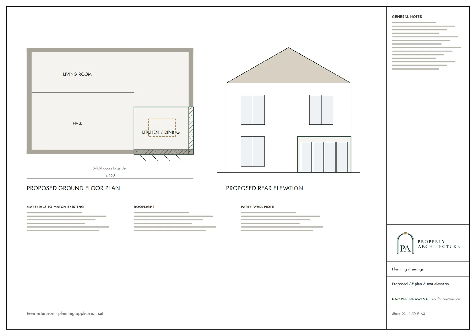
A basement impact assessment has no list price. After the free check you receive a fixed quote, and we say plainly if the policy limits rule your scheme out. Our planning drawings in Westminster carry the application.
The borough overview is architectural drawings in Westminster. To compare approaches, Camden uses a five-stage method, and the national rules are on the basement impact assessment hub.
What you receive
Related pages
Other services in Westminster
Questions
How much of my garden can a Westminster basement cover?
The City Plan limits a basement to no more than half of the garden land, with a proportionate margin left undeveloped. The exact wording is in the rules table on this page.
How deep can a basement go in Westminster?
One storey below the lowest original floor level, with the council citing about 2.7 m storey as the most appropriate depth, and exceptions only on large sites.
What else must accompany a Westminster basement application?
A signed Code of Construction Practice appendix, and a flood risk assessment and structural statement in the higher-risk zones. A landscaping strategy is needed where the basement sits under garden land.
What does it cost?
A fixed quote after a free constraints check.
Sources and dates
- westminster.gov.uk, retrieved
- westminster.gov.uk, retrieved
- planning.data.gov.uk, retrieved
- planning.data.gov.uk, retrieved
- planning.data.gov.uk, retrieved
- assets.publishing.service.gov.uk, retrieved
- westminster.gov.uk, retrieved
- legislation.gov.uk, retrieved
- planning.data.gov.uk, retrieved
- planning.data.gov.uk, retrieved
- nomisweb.co.uk, retrieved
- data.london.gov.uk, retrieved
- westminster.gov.uk, retrieved
- westminster.gov.uk, retrieved
- london.gov.uk, retrieved
- gov.uk, retrieved
- legislation.gov.uk, retrieved
- legislation.gov.uk, retrieved
- legislation.gov.uk, retrieved
- Contains public sector information licensed under the Open Government Licence v3.0.
- Contains OS data © Crown copyright and database right 2026.
- Contains HM Land Registry data © Crown copyright and database right 2026. This data is licensed under the Open Government Licence v3.0.
- Contains Historic England data © Historic England 2026. Contains Ordnance Survey data © Crown copyright and database right 2026.

Tell us about your property.
We check the constraints, then send a fixed fee. Messages before 3pm get a reply the same working day.